Mount Adams via north ridge (attempted)
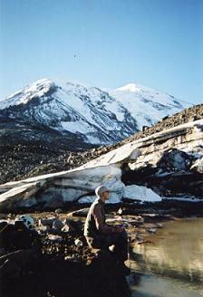
Left truck at Killen Creek trailhead at 10:30 PM, got to High Camp at
1:30 AM. We camped in the green area just SW of point 6928. Left
camp at 7:30 AM. There are campsites in the rock to the right of the
route higher up, and more sites on the NW shore of the lake (at 7,505
feet) at the bottom of the Adams Glacier. We followed a boot track
with occasional flags up to 9,700 feet (11:00 AM). We turned around
here because we were worried about getting fogged in. Back to the
campsite at 1:15 PM. I think it was about two hours from camp back to
the truck.
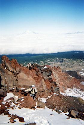
The rock and route finding were pretty easy but there was some
exposure, it sometimes looked like a fall could deposit you on the
Lava Glacier. The views from the north side of Adams were excellent,
when I awoke the lowlands were covered in clouds, leaving only Helens,
Rainier, and the Goat Rocks visible. And the Adams glacier is very
beautiful.
Date:
2004/09/03
to 2004/09/04
USGS quads:
Mount Adams East, Mount Adams West
Car-to-car:
18 hours
-
3 hours
ascending
from
Killen Creek trailhead
to
High Camp
-
3 hours 30 minutes
ascending
from
High Camp
to
9,700' on north ridge
-
2 hours 15 minutes
descending
from
9,700' on north ridge
to
High Camp
-
2 hours
descending
from
High Camp
to
Killen Creek trailhead
North ridge of Mount Adams
Ascending-the-north-ridge-of-Mount-Adams
Copyright © 2024 Gabriel Deal.