Boomerang Peak via logging roads
I parked at North Fork gate 11.
I rode my bike down road 32000, after crossing the North Fork
Snoqualmie River I went left on road 29000, after riding north for a
few miles I went right on road 29100. I followed road 29100 to
Calligan Lake where road 29100 takes a sharp left. I went straight
and followed the road that runs up Calligan Creek. The road was
closed before the first switchback (at 3,320'+) but I got permission to
continue. By the time I reached the third switchback corner (at
approximately 4,080') the road was consistently covered with snow, so
I parked my bike there. Up to this point the road was well-maintained and 90% of it was
gradual enough that I didn't have to get off my bike and push it up.
The road switchbacks up the side of Boomerang Peak further than
the Lake Philippa
shows, Greentrails shows more of the road but I
don't think it is accurate. I hiked up the road a bit until I came to
the little gully that runs SW down Boomerang Peak, I went up the
gully and got onto the little ridge to the right of the gully. I had
to do lots of self belay in a mixture of dirt and snow here. The
ridge was steep and had lots of little boulder fields, but the brush
was OK and I had no difficulties getting to the summit.
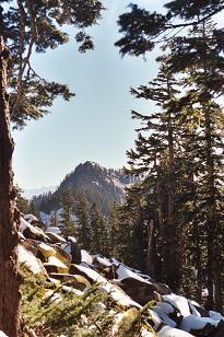
The summit had up close views of Twin Peaks (with Glacier Peak peeking
over the top), Goat Mountain (Lake Philippa quad), Lake Philippa, and
logged out forests. Trees blocked my view to the south and west, but
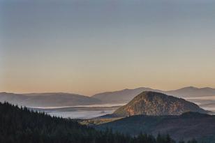
on my way up and down I caught some nice views of Paperboy Peak,
Moolock Mountain, and Mount Rainier.
I descended straight down the south side of Boomerang Peak, first
heading for the pass and then angling to the right toward the road
where my bike was parked. It was steep and slippery, but again I did
not encounter serious brush or unpassable obstacles.
Round-trip distance:
24 miles (1.3 miles on foot, 22.7 miles on bike)
Elevation gain:
4,185 feet
USGS quads:
Mount Si, Lake Philippa
In:
North Fork Snoqualmie Drainage
Car-to-car:
7 hours 21 minutes
-
14 minutes
driving there
from
Lower Queen Anne
to
intersection of I-90 and I-405
-
19 minutes
driving there
from
intersection of I-90 and I-405
to
exit 31
-
20 minutes
driving there
from
exit 31
to
North Fork gate 11 on the North Fork Road
-
1 hour 43 minutes
ascending via bike
from
North Fork gate 11 on the North Fork Road
to
Calligan Lake
-
1 hour 57 minutes
ascending via bike
from
Calligan Lake
to
where I parked my bike
-
1 hour 13 minutes
ascending
from
where I parked my bike
to
Boomerang Peak
-
48 minutes
descending
from
Boomerang Peak
to
where I parked my bike
-
29 minutes
descending via bike
from
where I parked my bike
to
Calligan Lake
-
43 minutes
descending via bike
from
Calligan Lake
to
North Fork gate 11 on the North Fork Road
Boomerang Peak via logging roads map
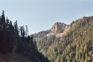
Fuller Mountain from road 29100
Paperboy Peak from side of Boomerang Peak
Hancock's Comb the road west of Lake Hancock
Twin Peaks from Boomerang Peak
Copyright © 2024 Gabriel Deal.