Thompson Point 5124 via Granite Creek Road-Trail
Ian and I parked at the Mailbox Peak trailhead and rode our mountain
bikes up the North Fork Road onto the gated Granite Creek Road-Trail.
We ditched the bikes shortly before we got to the Granite Lakes
intersection (where the picnic tables are), after this the road was
consistently covered with snow. At the start of the Thompson Lake
trail (#1009A) was the first particularly scenic spot on this trip, we
took a break for lunch here. We continued on the logging roads past
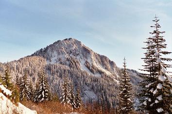
the trail and up to Thompson Point 5124. There was an excellent view
of Kaleetan Peak where the logging road meets the ridge just south of
Thompson Point 5124. At this point I slogged up the snowy, logged-out
south side of Thompson Point 5124 while Ian waited below.
Round-trip distance:
16 miles (7.8 miles on foot, 8.2 miles on bike)
Elevation gain:
4,490 feet
In:
Middle Fork Snoqualmie Drainage
Car-to-car:
7 hours 30 minutes
-
2 hours 17 minutes
ascending via bikes
from
Mailbox Peak trailhead
to
picnic table intersection
-
47 minutes
ascending
from
picnic table intersection
to
Thompson Lake trail intersection
-
1 hour 15 minutes
ascending
from
Thompson Lake trail intersection
to
Thompson Point 5124
-
1 hour 9 minutes
descending
from
Thompson Point 5124
to
picnic table intersection
-
1 hour 6 minutes
descending via bikes
from
picnic table intersection
to
Mailbox Peak trailhead
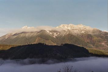
Mount Teneriffe and Green Mountain from Granite Creek Road-Trail
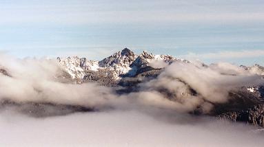
Kaleetan Peak from Thompson Point 5124
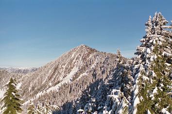
Revolution Peak from Thompson Point 5124
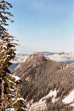
Russian Butte from Thompson Point 5124
Web Mountain from Granite Creek Road-Trail
Copyright © 2024 Gabriel Deal.