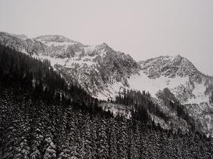
Jim Hill Mountain via Lanham Lake (attempted)
We snowshoed the Lanham Lake trail to the lake then ascended the
wooded ridge east of Lanham Lake toward the saddle between Jim Hill
Mountain and point 5707. Other than a few scrambly spots where we
pulled ourselves up by the brush we didn't encounter difficulties, but
I'm sure every party picks their own route up the side of the ridge, I
didn't see any obvious route. We overshot a bit and reached the top
of the corniced ridge at a point south of the saddle. Because of time
limitations we turned around here and returned the same way.
Elevation gain:
3,030 feet
USGS quads:
Stevens Pass, Labyrinth Mountain
Car-to-car:
7 hours 20 minutes
-
24 minutes
driving
from
Lower Queen Anne
to
160th Street Park and Ride
-
1 hour 29 minutes
driving
from
160th Street Park and Ride
to
Lanham Lake trailhead
-
1 hour 33 minutes
ascending
from
Lanham Lake trailhead
to
Lanham Lake
-
3 hours 2 minutes
ascending
from
Lanham Lake
to
saddle N of Jim Hill Mountain
-
2 hours 45 minutes
descending
from
saddle N of Jim Hill Mountain
to
Lanham Lake trailhead
Jim Hill Mountain from Lanham Lake
Copyright © 2024 Gabriel Deal.