Longs Pass (Teanaway)
There is a washout 1/4 a mile from the Esmerelda Trailhead. I
high-centered my Subaru here and we spent a lot of time jacking my car
up, digging up gravel, and feeling thankful we were doing this in
nice, sunny weather.
Carlos and I hit the trailhead at noon and changed our destination
from Fortune Peak and South Ingalls Peak to the more nearby Longs
Pass. Around 5,300' we lost the trail which was hidden under 1.5 feet
of snow and we just headed straight up to the pass. It's a pleasant
hike up with great views of Esmerelda Peaks all the way. At the pass
we found the summit of Mount Stuart hidden in the clouds and the rest
of the Stuart Range all visible, which was well worth the trip.
Round-trip distance:
3 miles
Elevation gain:
2,025 feet
Car-to-car:
4 hours 23 minutes
-
2 hours 31 minutes
ascending
from
Esmerelda trailhead
to
Longs Pass
-
1 hour 14 minutes
descending
from
Longs Pass
to
Esmerelda Trailhead
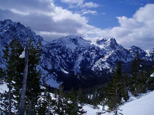
Esmerelda Peaks from below Longs Pass
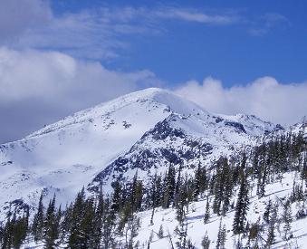
Fortune Peak from Longs Pass trail
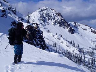
Carlos and Not Hinkhouse Peak from Longs Pass
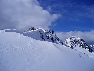
Looking north from Longs Pass
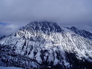
Mount Stuart from Longs Pass
Copyright © 2024 Gabriel Deal.