Colchuck Lake and Aasgard Pass
A Hollywood day. The pictures can describe this day much better than
I could ever hope to.
Round-trip distance:
12 miles
Elevation gain:
4,415 feet
USGS quad:
Enchantment Lakes
Car-to-car:
11 hours 22 minutes
-
2 hours 6 minutes
ascending
from
Lake Stuart trailhead
to
N side of Colchuck Lake
-
3 hours 22 minutes
ascending
from
N side of Colchuck Lake
to
Aasgard Pass
-
1 hour 59 minutes
descending
from
Aasgard Pass
to
S side of Colchuck Lake
-
2 hours 27 minutes
descending
from
S side of Colchuck Lake
to
Lake Stuart trailhead
-
3 hours 2 minutes
driving back
from
Lake Stuart trailhead
to
Lower Queen Anne
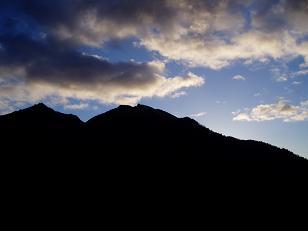
Sunrise on Icicle Ridge from Road 7601
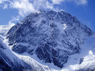
Dragontail Peak from Colchuck Lake
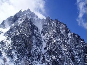
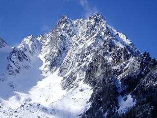
NE side of Dragontail Peak
NE side of Dragontail Peak
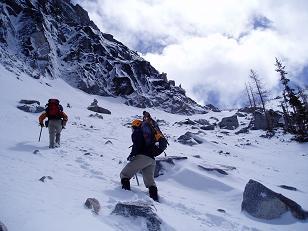
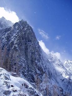
Ascending Aasgard Pass
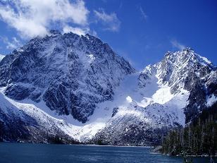
Dragontail Peak and Colchuck Peak over Colchuck Lake
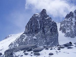
Witches Tower from Aasgard Pass
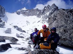
Brian, Carla, and Laurie at Aasgard Pass with Dragontail Peak in background
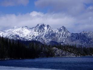
Colchuck Peak from Colchuck Lake
Cashmere Mountain from Colchuck Lake
Copyright © 2024 Gabriel Deal.