Russian Butte via Granite Lakes
Ian and I rode our mountain bikes up the Granite Creek Road-Trail, the
later part of this road is too steep for us to pedal up and it sure is
hard to push a bike up a road with a overnight pack on. We parked the
bikes shortly before the road that forks right to the Granite Lakes
and continued on up to Thompson Point 5124 on foot. We set up camp
where the logging road meets the top of the ridge at an intersection.
In good weather the view here is very nice, but we were in a cloud by
this time.
We awoke to worse visibility but at least no rain (yet). We went up
the ridge to a spur road that leads NE toward Revolution Peak,
followed that road to its end then traversed the clear-cut into
forest. The only difficulty on the way to Revolution Peak is a steep
gully that we had to drop below. Revolution Peak had a register.
We continued on north to the butte, eventually dropping down to the
east side of the ridge. We passed through some delightful meadow
land, is this really the middle fork? where is all the brush?!? Most
of this trip was remarkably brush-free.
We scrambled to the summit of Russian Butte from the SE side. This
involved 20-30 feet of wet rock that I found very challenging and not
at all enjoyable. At least in wet weather I prefer our descent route.
The summit register was the most interesting one I have come across.
The earliest entry I found was 2002. Entries included John Roper,
Mike Torok, Johnny Jeans, a guy who approached via Mason Lake (!), a
party that ascended from the Gifford Lakes, Bob Driesbach (author of
Seattle Outdoors: Hiking & Cycling-Puget Sound and Cascades), Carl Driesbach (author
Middle Fork Guide: Seattle's closest mountains), and Jeff
Howbert (
The Northwest Peakbaggers Asylum). The summit register was an unbound collection
of paper in a plastic bag inside a glass jar.
We descended via the steep heather slopes NE of the summit then
circled around to the south side, longer but no wet rock to downclimb.
After passing Revolution Peak we screwed up and encountered the steep
gully too high, instead of descending like we should have we crossed
the gully high on exposed, wet, dirt ledges, a low point of the trip
for both of us.
Quote of the trip: "I like big buttes, I cannot lie."
Date:
2005/07/01
to 2005/07/02
Round-trip distance:
22 miles (12 miles on foot, 10 miles on bike)
Elevation gain:
5,680 feet
In:
Middle Fork Snoqualmie Drainage
Car-to-car:
2 days
-
2 hours 58 minutes
ascending
from
Mailbox Peak trailhead
to
turnoff to Granite Lakes (near where we left our bikes)
-
1 hour 36 minutes
ascending
from
turnoff to Granite Lakes (near where we left our bikes)
to
camp below Thompson Point 5124
-
1 hour
ascending
from
camp below Thompson Point 5124
to
Revolution Peak summit
-
2 hours 42 minutes
ascending
from
Revolution Peak summit
to
Russian Butte summit
-
4 hours 19 minutes
descending
from
Russian Butte summit
to
camp below Thompson Point 5124
-
50 minutes
descending
from
camp below Thompson Point 5124
to
turnoff to Granite Lakes (near where we left our bikes)
-
55 minutes
descending
from
turnoff to Granite Lakes (near where we left our bikes)
to
Mailbox Peak trailhead
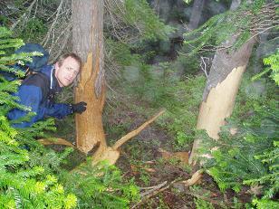
The bears seem hungry around here
Copyright © 2026 Gabriel Deal.