Columbia River Gorge bumps
I got into Vancouver around noon and was short on time but wanted to
get outside, so I decided to hike up a couple of the local bumps that
I'd seen so many times, Wind Mountain and Aldrich Butte.
I followed the driving directions on
Summitpost.org to the Wind Mountain
trailhead. Despite being an unofficial trail (not on any of my maps),
it was a good trail complete with three signs near the top about the
indian pits on the summit. It has nice local views from the summit,
an excellent short hike. On the way down around 1,150' on the NE side
of Wind Mountain I followed a bootpath off of the trail that lead a
short way down to an attractive, exposed little butte projecting from
the side of the mountain.
After returning to my car I drove over to the road that runs along the
NW side of Greenleaf Slough. I parked on the road before it crosses
the power lines and jogged and hiked up the road to the top of Aldrich
Butte. The road would be easily mountain biked. The very summit of
Aldrich Butte was a little mysterious with its stairway to nowhere and
the concrete monolith. It's odd that a fire lookout was built on such
a small peak.
Elevation gain:
2,235 feet
Trip type:
hike/trail run
USGS quads:
Bonneville Dam, Carson
In:
Columbia River Gorge, Southern Washington Cascades
Car-to-car:
2 hours 24 minutes
-
1 hour 2 minutes
driving there
from
Vancouver (Fischer's Landing)
to
Wind Mountain trailhead
-
28 minutes
ascending
from
Wind Mountain trailhead
to
summit of Wind Mountain
-
30 minutes
descending
from
summit of Wind Mountain
to
Wind Mountain trailhead
-
29 minutes
ascending
from
Aldrich Butte trailhead
to
summit of Aldrich Butte
-
21 minutes
descending
from
summit of Aldrich Butte
to
Aldrich Butte trailhead
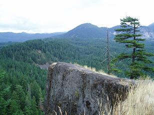
Little butte on NE side of Wind Mountain
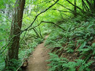
Wind Mountain trail
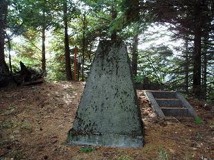
The mysterious summit of Aldrich Butte
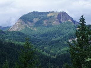
Table Mountain from summit of Aldrich Butte
Copyright © 2024 Gabriel Deal.