Big Snow Mountain
Carlos and I parked at the Dingford Creek trailhead and headed up the
Myrtle/Hester Lakes trail. At the intersection we went east on the
trail to Hester Lake, the trail was its usual swampy, slippery self,
also very pretty with all its old-growth cedar. We passed through a
meadow (often so marshy people have to detour around it) and then
crossed a permanent stream, soon after that (around 3,360') we turned
off the trail to head east up a gentle, brushy basin.
At around 4,000' elevation in the basin we turned north and headed up
the west side of a large avalanche chute. At 4,920' elevation we
entered a meadow that shows clearly on USGS as a level area. From the
meadow we headed east to a nearby ridge and from the ridge wended our
way north through increasingly beautiful alpine meadows and granite to
the summit.
The summit had a cairn made of quartz with a summit register dating
back to 1995 underneath. Nude hiking was a recurring theme in the
register, I guess Big Snow is the place to do it. The views from the
summit were great, Mount Baker and Glacier Peak prominent in the
north, the upper Middle Fork peaks dominated the nearby scene (most
prominently Lemah Mountain, Overcoat Peak, and Chimney Rock), and
Mount Rainier and Mount Adams visible to the south.
We made our camp near the summit on the SE ridge, Carlos in his tent
and I in my bivy sack. After 3,800' in the basin there was no water
on our route, so I was glad we had each brought up a gallon.
The next day we descended the same way until we got to the basin, here
in an attempt to avoid the brush, I led us down the north side of the
basin, where we met with thick, wet, persistent brush that didn't let
up until we hit the trail. So much for that.
Date:
2005/09/24
to 2005/09/25
Elevation gain:
5,305 feet
USGS quad:
Big Snow Mountain
In:
Middle Fork Snoqualmie Drainage, Alpine Lakes Wilderness
Car-to-car:
2 days
-
1 hour 27 minutes
driving there
from
Lower Queen Anne
to
Dingford trailhead
-
7 hours 5 minutes
ascending
from
Dingford trailhead
to
Big Snow Mountain summit
-
4 hours 30 minutes
descending
from
Big Snow Mountain summit
to
Dingford trailhead
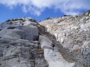
Granite steps near summit of Big Snow Mountain
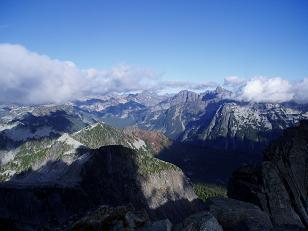
Upper middle fork valley from summit of Big Snow Mountain
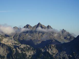
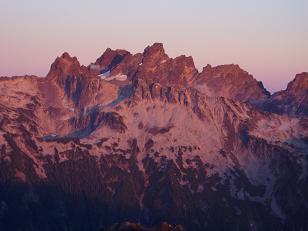
Lemah Mountain from summit of Big Snow Mountain
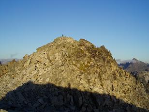
Summit of Big Snow Mountain
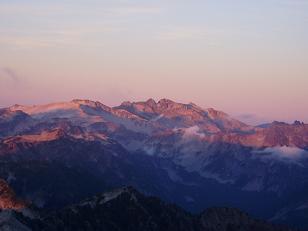
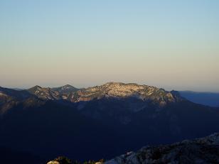
Sunset on Mount Hinman and Mount Daniel from summit of Big Snow Mountain
Sunset on Overcoat Peak and Chimney Rock from summit of Big Snow Mountain

Sunrise behind Lemah Mountain from summit of Big Snow Mountain
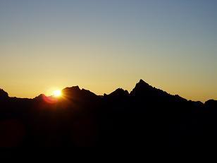
Sunrise over Summit Chief Mountain from summit of Big Snow Mountain
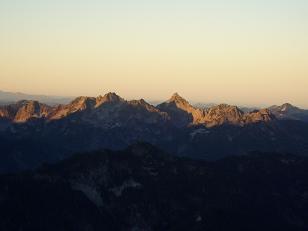
Chair Peak and Kaleetan Peak from summit of Big Snow Mountain
Preacher Mountain from summit of Big Snow Mountain
Copyright © 2026 Gabriel Deal.