Sky Mountain via Skyline Lake
Carla and I parked in the Stevens Pass parking lot on the north side
of Highway 2 and hiked up the road to Skyline Lake. A snow cat had
recently driven up the road to the radio tower at 5,200' (above the
one marked on USGS), which made travel easy. We took one of half a
dozen paths beaten into the snow leading from the road to Skyline
Lake.
Skyline Lake was frozen over and it looks like some people had skied
over it during the cold weather last week. We skirted the lake on the
south side and ascended NW to the top of the ridge. We soon found
ourselves in a beautiful field of granite boulders leading to the
5,440'+ high point on Skyline Ridge.
Here we made the mistake of scrambling up the east side of the 5,440'+
high point, which involved a bit of semi-exposed scrambling on icy
rock, probably easy when dry but challenging in these conditions. On
the way back we bypassed this section by traversing below it to the
south.
After 5,440'+ we dropped south for a short distance to bypass some
rock, after that the trip was a stroll on the ridge leading to the top
of Sky Mountain. Occasional openings in the clouds revealed good
views in all directions (including a birds eye view of Highway 2) as
we snowshoed up the ridge to Sky Mountain.
Snow turned to rain as we summited and we headed straight back,
stopping once to take shelter underneath a leaning granite boulder
west of the lake for a quick lunch.
Elevation gain:
1,450 feet
USGS quad:
Labyrinth Mountain
Car-to-car:
4 hours 48 minutes
-
56 minutes
ascending
from
Stevens Pass parking lot
to
Skyline Lake
-
1 hour 43 minutes
ascending
from
Skyline Lake
to
summit of Sky Mountain
-
2 hours 9 minutes
descending
from
summit of Sky Mountain
to
Stevens Pass parking lot
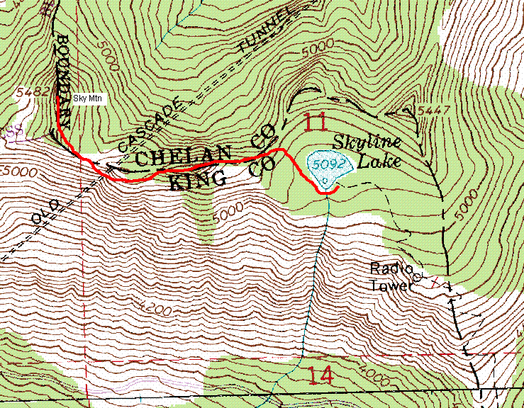
Route to Sky Mountain
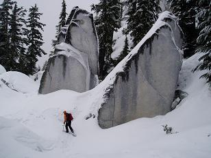
Granite boulders on Skyline Ridge
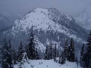
SE side of Tye Peak from Skyline Ridge
Copyright © 2024 Gabriel Deal.