Mineral Butte via SE ridge
Ben, Bruno, Carla, and I drove up Road 6330 (off of the North Fork
Skykomish Road) past the first big switch back and parked around
1,800'. I could have driven past two more switch backs but was
worried that I would run into rougher road and have to back down a
long way, as it turned out that wouldn't have been a problem.
We hiked Road 6330 up the SE ridge of Mineral Butte, the logging road
goes much higher than shown on Green Trails or USGS. Occasionally the clouds
would lift to reveal Spire Mtn, Scott Peak, and Bear Mountain, I'll
bet there are a lot of good views on a clear day! Except for the
final few hundred feet, the route was very moderate and well protected
from avalanches. The final few hundred feet were a sometimes steep
but straight-forward scramble up to the summit of Mineral Butte.
Elevation gain:
3,605 feet
In:
North Fork Skykomish Drainage
References:
Winter Climbs: One Day Ascents (out of print)
Car-to-car:
7 hours 33 minutes
-
4 hours 16 minutes
ascending
from
car
to
summit of Mineral Butte
-
2 hours 47 minutes
descending
from
summit of Mineral Butte
to
car
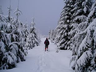
Snowshoeing up Road 6330 on Mineral Butte
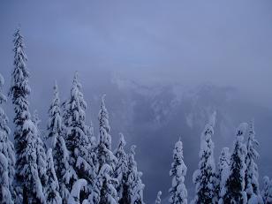
Scott Peak almost shows itself
Copyright © 2024 Gabriel Deal.