Cascade Lookout
I parked on the North Fork Snoqualmie Road between gates 31 and 32 and
headed north up road 29410. At 1,300' I turned right (east) at the
four-way intersection onto road 29400. At 1,767' I took a left onto
road 29500. At 1,840'+ I took a left onto road 29520. I hit snow
around 3,000' on the north side of the 3,087' ridge that road 29520
hairpins around, from here on I was able to ski. I wished I had
brought my mountain bike for the logging roads leading up to this
point. At the four way intersection at 2,800'+ I turned right (east)
onto road 29600. (Most of these roads are not labeled on maps, but do
have street signs naming them.)
Before following the road to Cascade Lookout I took a long detour
to ski up the logging roads running east below the ridge.
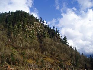
Cascade Lookout was an excellent destination. The lookout is
elevated above the young trees in the area and has a nice 360 degree
view. Many of the east and west windows are broken and boarded up,
but all the north and south facing windows are intact. The door is
broken off. I enjoyed sitting inside and taking in the views which
included downtown Seattle, Twin Peaks, Boomerang Mountain, Mount Si,
Mount Teneriffe, Mouth Phelps, Little Phelps, Rattlesnake Mountain,
and Fuller Mountain.
Elevation gain:
3,180 feet
Trip type:
cross country ski
In:
North Fork Snoqualmie Drainage
Car-to-car:
10 hours 7 minutes
-
1 hour 10 minutes
driving there
from
Lower Queen Anne
to
North Fork Snoqualmie Gates 31 and 32
-
4 hours 53 minutes
ascending
from
North Fork Snoqualmie Gates 31 and 32
to
peak
-
2 hours 1 minute
descending
from
peak
to
Cascade Lookout
-
2 hours 21 minutes
descending
from
Cascade Lookout
to
North Fork Snoqualmie Gates 31 and 32
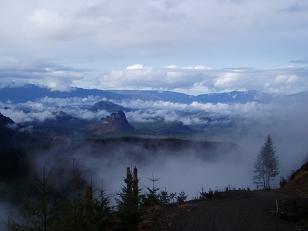
North Fork Snoqualmie Valley (looking down valley), Fuller Mountain and Pelletgun Hill visible on valley floor
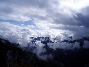
North Fork Snoqualmie Valley (looking up valley)
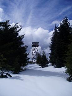
Cascade Lookout
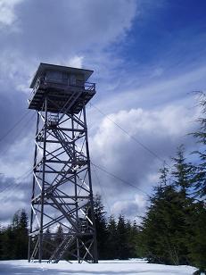
Cascade Lookout
Pelletgun Hill from North Fork Road
Copyright © 2024 Gabriel Deal.