Archer Mountain loop
Dad and I turned north off of Highway 14 onto Smith-Cripe Road, drove
to the end of Smith-Cripe, and parked at the big turn-around there.
We hiked up the gated gravel road 1853 to a meadow, the road forks
three ways in the meadow, we took the left fork which was the most
traveled. I think it would have been easier if we took the middle
fork (which had a sign labeling it 159), since we ended up
bushwacking back to it then following it to where it approaches the
creek that runs south along the west side of Archer Mountain.
At the creek we turned off the road and headed north up the basin on a
faint way-trail on the west side of the creek. This way trail
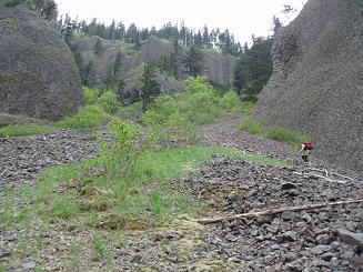
eventually led us to the north end of the basin which is a large,
mossy, open, talus field with a wonderful waterfall at the north end.
At the base of the waterfall are two interesting rock monoliths.
We scrambled up the large gully west of the waterfall, a trip report
I had read said the gully is 50 degrees but my inclinometer read 35 -
40 degrees. We traversed east above the waterfall where we found a
beautiful field of Camas Lilies. From the top of the waterfall we
headed SE along the side of the N ridge of Archer, eventually gaining
the top of the ridge where we found a very old logging road.
We followed the logging road south then east until it turned into a
faint way trail that soon intersected with a well traveled trail that
led to just SE of the summit of Archer Mountain. Here the trail
splits, one fork leading to the summit of Archer (a nice ridge trail,
and a pleasant but treed summit) and the other fork leads to a very
impressive, exposed point with views of Hamilton Mountain, Beacon
Rock, and Multnomah Falls.
We returned via a trail that runs down the south ridge of Archer
Mountain, then traverses down the west side of Archer. This trail is
very exposed at spots, has some scrambly sections, has nice views, and
a couple pretty lily fields. The trail eventually leads to a logging
road which turned out to be the right-most and faintest of the three
forks in the road in the meadow that we started in.
All in all a surprising and beautiful trip. But even the sections of
the trip with a trail are only for experienced people who are sure of
their footing.
Elevation gain:
1,480 feet
USGS quad:
Multnomah Falls
Car-to-car:
5 hours 29 minutes
-
1 hour 38 minutes
ascending
from
end of Smith-Cripe Road
to
waterfall
-
1 hour 59 minutes
ascending
from
waterfall
to
viewpoint SE of summit
-
27 minutes
ascending
from
viewpoint SE of summit
to
summit of Archer Mountain
-
1 hour 9 minutes
descending
from
summit of Archer Mountain
to
creek
-
16 minutes
descending
from
creek
to
end of Smith-Cripe Road
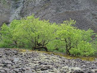
Maple trees in Archer Waterfall basin
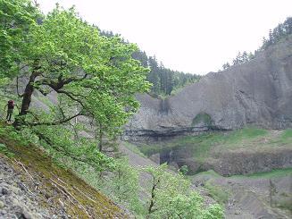
Archer Waterfall
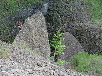
Monoliths below Archer Waterfall
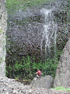
Archer Waterfall
Gully west of Archer Waterfall
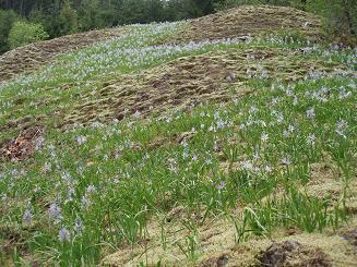
Field of Camas Lilies above Archer Waterfall
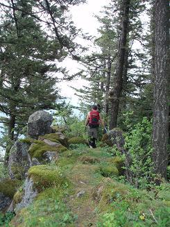
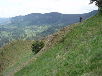
Path to the viewpoint SE of the summit of Archer Mountain
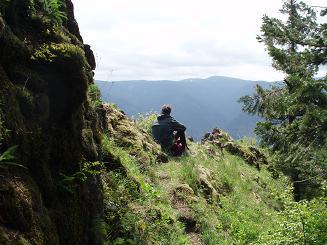
Viewpoint SE of the summit of Archer Mountain
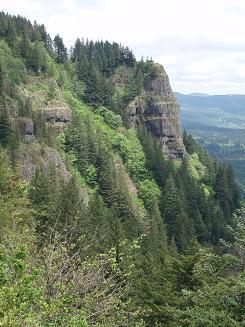
The viewpoint SE of the summit of Archer Mountain as seen from the trail on the S ridge of Archer Mountain
Lily field on the Archer Mountain trail
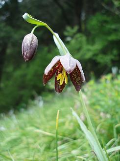
Chocolate Lily on the Archer Mountain trail
Copyright © 2024 Gabriel Deal.