Mount Challenger via Easy Ridge (attempted)
Ian and I parked at the Hannegan Pass trailhead, and headed up
Hannegan Trail (#674) over Hannegan Pass and into the Chilliwack River
valley. Between US Cabin Camps and the creek crossing with a USGS
benchmark plaque (on a boulder after the first big creek crossing
after Copper Creek), we found the climbers trail that crosses the
Chilliwack River. It was a pretty obvious trail intersection. From
the north side of the river we could see what looked like old pilings
for a bridge that must have been used when the Easy Ridge lookout was
in service.
I forded the Chilliwack River 40 feet upstream from the trail, Ian
crossed on a log 20 feet downstream. The trail picked up next to the
old pilings. Except for blowdowns and a couple brushy spots, the
trail was in good condition and easily followable. It continues onto
the ridge and well beyond the summit of Easy Peak.
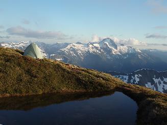
We made our first camp where the climbers path reaches the top of the
ridge. It was a good site with a tarn nearby and room for a couple
tents.
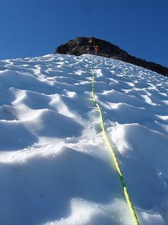
The next day we followed the bootpath up Easy Ridge. There was a
short scramble on steep snow and rock at 6,400' shortly before
reaching the summit of Easy Peak. We found two nice tent spots and a
tarn on the summit of Easy Peak. Shortly before point 6,553' on Easy
Ridge we started making a descending traverse across lovely open
meadows down to the base of a buttress of Whatcom Peak where we found
Imperfect Impasse.
At Imperfect Impasse (a deep chasm with vertical walls) we scrambled
around looking at the high route. We weren't sure if a single-rope
rappel would suffice to get down the impasse, and we had heard stories
of parties that got sketched out while doing the high route, so we
decided to play it safe and descend to a lower crossing.
We found our low crossing around 4,450'. After crossing the impasse we
pushed through some dense brush (the only bushwacking on the whole
trip) until we came to a steep meadow. We followed the meadow to an
exposed ramp, we scrambled up the ramp, at the top of the ramp we
found a rappel station. From the rappel station it was a
straight-forward scramble, sometimes on steep meadows of heather and
granite, to Perfect Pass.
We camped in a little-used tent site on the south side of Perfect
Pass. Ian scrambled around and found a couple more tent sites a
couple hundred feet higher up on the south side of the pass.
The next morning we woke to white-out conditions. We roped up and
headed for a rock outcropping a few hundred feet out on the glacier,
it was eerie to have the other person on the rope dissappear in the
swirling fog. For hours we waited for the fog to lift. When it
finally permanently lifted it was noon and we decided we had missed
our window and were out of time, so we broke camp and headed home.
On the descent to the bottom of Imperfect Impasse, we did one
single-rope rappel down the ramp. On the second day, we belayed each
other down the exposed, frozen snow slope at 6,400' on the north side
of Easy Peak.
Date:
2006/07/13
to 2006/07/16
Elevation gain:
12,720 feet
Car-to-car:
4 days
-
3 hours 11 minutes
driving there
from
Capitol Hill
to
Hannegan Pass trailhead
-
2 hours 20 minutes
ascending
from
Hannegan Pass trailhead
to
Hannegan Pass
-
2 hours 52 minutes
ascending
from
Hannegan Pass
to
Chilliwack River crossing
-
3 hours 16 minutes
ascending
from
Chilliwack River crossing
to
first campsite on Easy Ridge
-
2 hours 3 minutes
ascending
from
first campsite on Easy Ridge
to
summit of Easy Peak
-
2 hours 45 minutes
ascending
from
summit of Easy Peak
to
Imperfect Impasse
-
26 minutes
ascending
from
Imperfect Impasse
to
bottom of Imperfect Impasse
-
2 hours 26 minutes
ascending
from
bottom of Imperfect Impasse
to
campsite at Perfect Pass
-
2 hours 3 minutes
descending
from
campsite at Perfect Pass
to
bottom of Imperfect Impasse
-
4 hours 8 minutes
descending
from
bottom of Imperfect Impasse
to
campsite on summit of Easy Peak
-
4 hours 9 minutes
descending
from
campsite on summit of Easy Peak
to
Chilliwack River crossing
-
3 hours 28 minutes
descending
from
Chilliwack River crossing
to
Hannegan Pass
-
1 hour 38 minutes
descending
from
Hannegan Pass
to
Hannegan Pass trailhead
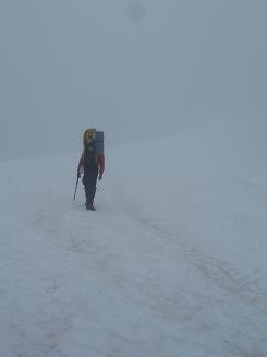
Ascending Easy Ridge
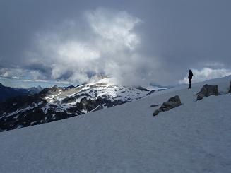
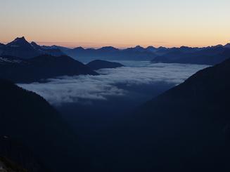
Looking east from Perfect Pass
Looking SE from Perfect Pass
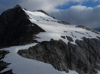
Whatcom Peak from Perfect Pass
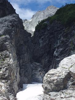
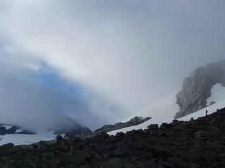
Bottom of Imperfect Impasse
Mount Blum from Easy Peak
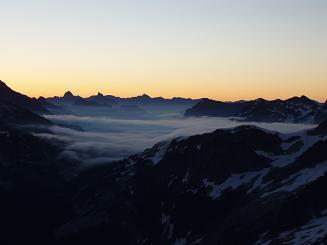
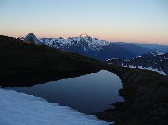
Looking NE from Easy Peak at sunrise
Looking north from Easy Peak at sunrise
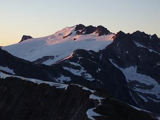
Mount Challenger from Easy Peak
Mount Blum from Easy Peak
Descending frozen snow slope on Easy Ridge (NW of Easy Peak)
Copyright © 2024 Gabriel Deal.