Navaho Peak, Little Navaho, and the Three Brothers
Brett and I parked on Stafford Road and headed up the Stafford Creek
trail (#1359). At Navaho Pass (west of Navajo Peak) we headed east on
the County Line Trail. Where the trail leaves the ridge and starts
contouring across the south side of Navaho Peak, we followed a
bootpath (not on maps) that leads up the ridge to the summit of Navaho
Peak. Great views of the Stuart Range from here.
From the summit we followed the SE ridge of Navaho, which went with no
difficulties. Shortly after crossing the trail we found a somewhat
flat, vegetation-less spot to bivy on the ridge.
In the morning we headed east down the trail, wasting at least half an
hour on a miscommunication that got us separated for a while. But
eventually we were reunited and were heading up the west ridge of
Three Brothers. This was a good scramble ridge with nice views of the
Start Range, there were many small cliffs to thread through (I
think many ways would go). We made it to the main summit of Three
Brothers with no difficulties. This was one of the only summits I've
been to that had two summit registers.
From the summit we headed down the ridge but soon dropped SW down the
mild slopes of Three Brothers to where Negro Creek meets the gully
that leads up to the 5,960'+ pass between Navaho Peak and Little
Navaho. We followed the gully up to the pass, then took the ridge up
to Little Navajo.
From Little Navaho we dropped back to the 5,960'+ pass, then dropped
down the west side of the pass toward the Stafford Creek trail,
staying on the south side of the creek/gully.
The hike back to the trailhead went quickly.
Nothing on this trip exceeded class 2. Lots of open country, peaks,
and some excellent views. A very good trip.
Date:
2006/09/16
to 2006/09/17
Elevation gain:
6,285 feet
USGS quad:
Enchantment Lakes
Car-to-car:
2 days
-
3 hours 53 minutes
ascending
from
Stafford Creek trailhead (trail #1359)
to
Navaho Peak
-
34 minutes
descending
from
Navaho Peak
to
campsite on S ridge of Navaho Peak
-
1 hour
descending
from
campsite on S ridge of Navaho Peak
to
valley floor
-
1 hour 4 minutes
ascending
from
valley floor
to
SW peak of Three Brothers
-
1 hour 26 minutes
descending
from
SW peak of Three Brothers
to
valley floor
-
49 minutes
ascending
from
valley floor
to
summit of Little Navaho
-
54 minutes
descending
from
summit of Little Navaho
to
back on Stafford Creek trail (#1359)
-
1 hour 3 minutes
descending
from
back on Stafford Creek trail (#1359)
to
Stafford Creek trailhead (trail #1359)
-
2 hours 8 minutes
driving back
from
Stafford Creek trailhead (trail #1359)
to
65th St Park and Ride
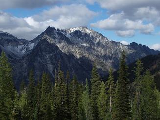
McClellan Peak from Navaho Pass
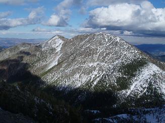
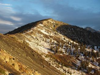
Three Brothers from Navaho Peak
Little Navaho from south ridge of Navaho Peak
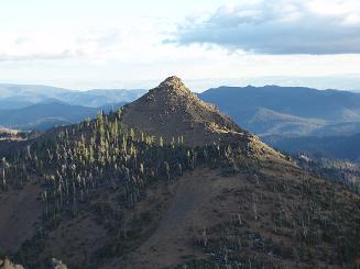
Three Brothers, SW peak from south ridge of Navaho Peak

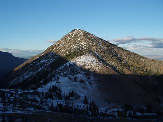
Earl Peak from south ridge of Navaho Peak
Navaho Peak from south ridge of Navaho Peak
Copyright © 2024 Gabriel Deal.