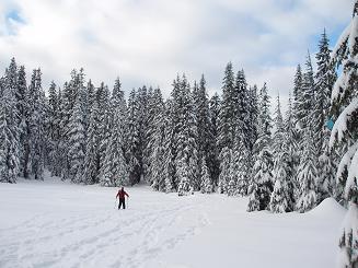
Olallie Meadows via Nordic Pass trail
The roads leading to the trailhead on my Snoqualmie Pass quad
were inaccurate, causing us to wander around a bit.
We did this on skis and at the end we all agreed it is a snowshoe route.
There were not many long, open downhill slopes between Hyak and Nordic
Pass, we dodged a lot of trees. There was also a lot of gradual
uphill on the way down, but it went OK with scales on our skis.
Elevation gain:
1,385 feet
Trip type:
backcountry ski
USGS quads:
Snoqualmie Pass, Lost Lake
In:
South Fork Snoqualmie Drainage
Car-to-car:
7 hours
-
3 hours 5 minutes
ascending
from
Nordic Pass trailhead (at creek)
to
Nordic Pass
-
1 hour 3 minutes
ascending
from
Nordic Pass
to
our high point in Olallie Meadows
-
52 minutes
descending
from
our high point in Olallie Meadows
to
Nordic Pass
-
2 hours
descending
from
Nordic Pass
to
Nordic Pass trailhead (at creek)
-
1 hour 7 minutes
driving back
from
Hyak parking lot
to
65th Street Park and Ride
Nordic Pass trail
Copyright © 2024 Gabriel Deal.