Keechelus Ridge from Price Creek Sno-park
I parked at the west Price Creek Sno-park (the land of snowmobiles)
and headed up a trail that connects to Road 4832. I followed 4832
west over Noble Creek and Price Creek to Road 124, and headed up 124.
Road 124 was "groomed" by snowmobiles, but I didn't see any
snowmobiles on 124 on the way up or down.
Since I was solo, I stuck to the road, many snowshoers headed
cross-country NNE up the slope. At the big, four-way intersection at
4,280'+, I took the left fork (east). At the next three-way
intersection at 4,440'+, I took the sharp left (NW). Soon I could see
the radio tower on my right.
On the way up I ran into
Northwest Hikers regulars Trail Pair, Sadie's
Driver, and JimK. And then I ran into them again. And again.
I counted 14 snowmobiles sitting under the radio tower. That didn't
include the snowmobiles that were zooming around.
From the radio tower I continued SE up Keechelus Ridge to its summit.
I was surprised no other tracks led up there, but it went easily and
was a nice ski down.
There were loads of tree-free, untracked, moderate slopes around the
radio tower. The ski down the road was great, the snowmobile tracks
kept friction down on the gradual parts, and when it was steeper and
narrow I widened my turns to include the powder on the side of the
road to burn off some speed. I'll come back to this one. I had a
blast!
On my way down, I encountered many, many snowshoers, some were still
heading up from the parking lot when I pulled out at 1:20 PM.
Elevation gain:
2,860 feet
Car-to-car:
4 hours
-
1 hour 4 minutes
driving there
from
Lower Queen Anne
to
Price Creek Sno-park
-
2 hours 9 minutes
ascending
from
Price Creek Sno-park
to
radio tower
-
24 minutes
ascending
from
radio tower
to
summit of Keechelus Ridge
-
16 minutes
descending
from
summit of Keechelus Ridge
to
radio tower
-
46 minutes
descending
from
radio tower
to
Price Creek Sno-park
-
1 hour 12 minutes
driving back
from
Price Creek Sno-park
to
Lower Queen Anne
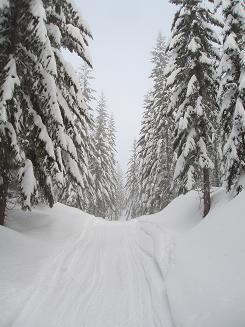
Road 124 up Keechelus Ridge
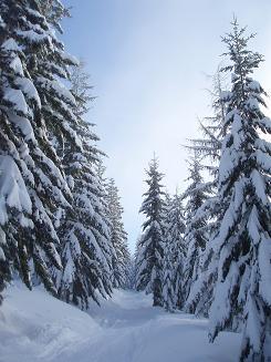
Road 124 up Keechelus Ridge
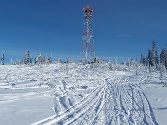
Radio tower on Keechelus Ridge (snowmobile heaven)
Copyright © 2026 Gabriel Deal.