Red Bluffs (Columbia River Gorge)
Dad and I parked at the intersection of CG-2020 and CG-2022. We
crossed the berms on CG-2022 and headed up the road. CG-2022 passes
through a gravel pit, then shortly after it seemingly dead-ends it a
tangle of downed trees. But on the other side of the downed trees the
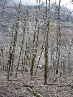
road continues in a more primitive form. Soon after that we could see
Red Bluffs through the trees and we headed cross country to the bluff.
We went cross-country below the bluffs all the way to Greenleaf Creek.
We passed through a number of distinct areas. One was sandy and flat
with cottonwood, alder, and cedar trees. We passed through many
boulder fields, some tippy and scary, others covered in deep moss.
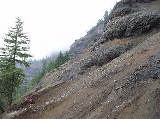
Once we crossed a steep field of fine, red scree. And there was some
bushwacking.
Once we reached the creek, we returned via logging roads. For a while
the roads passed through boulder fields that had excellent views of
the impressive east face of Table Mountain. These roads would make
good mountain bike destinations. But the road eventually devolved to
a long slog through the woods.
On the way back we heard rock fall from the bluffs twice, one went on
for 30 seconds.
USGS quad:
Bonneville Dam
In:
Columbia River Gorge, Southern Washington Cascades
Car-to-car:
5 hours 48 minutes
-
3 hours 20 minutes
ascending
from
Intersection of CG-2020 and CG-2022
to
where the trail crosses Greenleaf Creek
-
2 hours 28 minutes
descending
from
where the trail crosses Greenleaf Creek
to
Intersection of CG-2020 and CG-2022
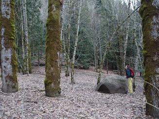
Flats below Red Bluffs
Red Bluffs
Flats below Red Bluffs
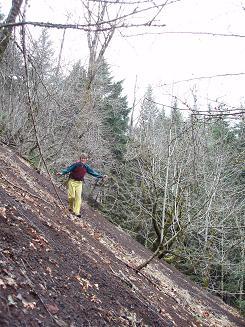
Scree slope just east of Greenleaf Creek
Copyright © 2024 Gabriel Deal.