Rampart Ridge SE Peak after hours
Due to road erosion from last winter, we had to park about a quarter
mile from the Rocky Run trail head (which is at the northern-most
point on Road #136). Rampart Ridge SE Peak is clearly visible from
here. The road is still passable all the way to the trail head for
reasonably high-clearance vehicles, there was a Subaru Outback parked
at the trail head.
We hiked up the trail toward Lake Lillian. Just before reaching Lake
Lillian, we took the right fork in the trail. The right fork climbs a
short distance then contours around the east side of the lake. We
left the trail where it starts contouring and ascended the ridge that
runs SE to the 5,606' summit of Rampart Ridge. This route is class 2,
it is mostly steep meadow and heather with very little brush.
Elevation gain:
1,985 feet
Car-to-car:
2 hours 49 minutes
-
45 minutes
ascending
from
near the Rocky Run Trailhead
to
where we left the trail above Lake Lillian
-
31 minutes
ascending
from
where we left the trail above Lake Lillian
to
summit of Rampart Ridge SE Peak
-
26 minutes
descending
from
summit of Rampart Ridge SE Peak
to
where we left the trail above Lake Lillian
-
54 minutes
descending
from
where we left the trail above Lake Lillian
to
near the Rocky Run Trailhead
-
58 minutes
driving back
from
near the Rocky Run Trailhead
to
High Point exit (exit 20)
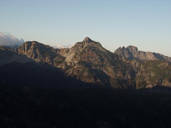
Hibox Peak from Rampart Ridge SE Peak
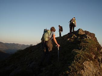
Rampart Ridge SE Peak
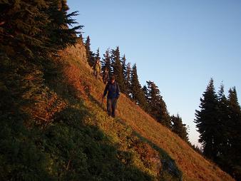
Descending meadow beneath the summit of Rampart Ridge SE Peak
Copyright © 2024 Gabriel Deal.