Polallie Ridge via Tired Creek
I drove up Road 45 toward Cooper Lake, the road was covered in snow
and had been taken over by snowmobilers. I was conspicuous in my
Subaru among all the snowmobiles and trucks with trailers. I turned
off onto road 4616 and parked where trail 1311 crosses the road.
I had planned to take trail 1323 past Cooper Lake, but Road 4615
looked easier to follow so I just hiked up the road. Tired Creek woke
me up after plodding on the road for an hour, the creek was icy,
larger than I expected, and had no bridge. I found a decent crossing
upstream from the road.
I hit the Tired Creek Trail immediately after crossing the creek. The
trail was snow-covered but easy to follow. There were a few
peek-a-boo views on the way up, but it was mostly hiking through
woods. The views got great shortly before the lookout site.
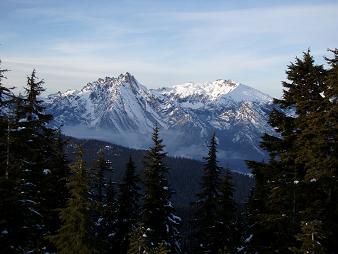
I set up camp at the Polallie Ridge lookout site, point 5482 on the
north end of the ridge. What a great place to camp, from my bivy spot
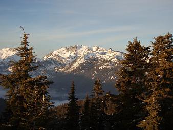
I had a rare, sweeping view of Three Queens, Four Brothers, Chikamin
Peak, Lemah Mountain, Chimney Rock, Summit Chief, Bears Breast, Mount
Hinman, Mount Daniel, and many Teanaway peaks in the distance with
Mount Stuart rising above them.
In the morning I snowshoed to the northern-most of Polallie Ridge's
two summits. A pleasant ridge walk, but the views at the lookout site
were the best.
Date:
2007/11/23
to 2007/11/24
Elevation gain:
2,855 feet
USGS quad:
Polallie Ridge
Car-to-car:
23 hours 45 minutes
-
1 hour 12 minutes
ascending
from
Intersection of Road 4616 and trail 1311
to
Intersection of Road 4616 and trail 1317
-
2 hours 1 minute
ascending
from
Intersection of Road 4616 and trail 1317
to
Polallie Ridge lookout site
-
29 minutes
ascending
from
Polallie Ridge lookout site
to
Summit of Polallie Ridge
-
33 minutes
descending
from
Summit of Polallie Ridge
to
Polallie Ridge lookout site
-
1 hour 14 minutes
descending
from
Polallie Ridge lookout site
to
Intersection of Road 4616 and trail 1317
-
53 minutes
descending
from
Intersection of Road 4616 and trail 1317
to
Intersection of Road 4616 and trail 1311
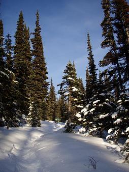
Hiking up the Tired Creek trail
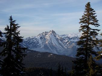
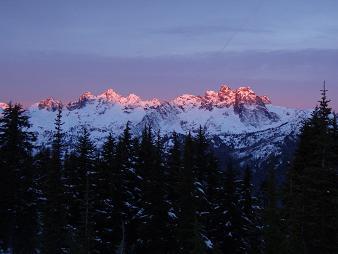
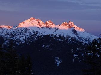
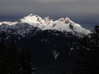
Bears Breast Mountain from Polallie Ridge
Bears Breast Mountain and Mount Hinman from Polallie Ridge
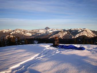
Camp at the Polallie Ridge lookout
Mount Daniel from Polallie Ridge lookout
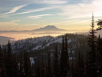
Mount Rainier from Polallie Ridge
Lemah Mountain and Chimney Rock from Polallie Ridge lookout
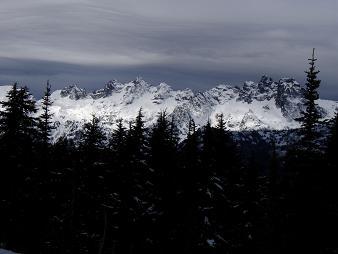
Three Queens from Polallie Ridge lookout
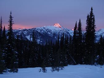
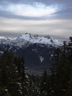
Summit Chief from Polallie Ridge lookout
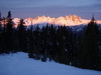
Lemah Mountain and Chimney Rock from Polallie Ridge lookout
Vortex above Summit Chief
Lemah Mountain and Chimney Rock from Polallie Ridge lookout
Summit Chief from Polallie Ridge lookout
Copyright © 2024 Gabriel Deal.