Mount Townsend loop
Summary: This is a gorgeous area, it was one of my favorite trips of
the year. Avoid ascending the summit block from the east. Avoid the
broken-up, slabby section of rock that is NE of Eagle Lake.
--
Lindsay, Kevin, and I parked on a the road that forks off of FS Road
6517 right before the Eagle Creek bridge. We hiked up the trail that
runs above the south side of Eagle Creek. After half an hour hiking
the trail, we left the trail, crossed Eagle Creek, and started up a
boulder field that nearly stretches from Eagle Creek to the top of
Townsend's east ridge.
Eventually we traversed left off the boulder field to the east side of
Townsend's summit block. None of us found a easy route to the top,
mine involved a ten foot section of 5th class with some exposure. If
I were to do this again, I'd traverse the meadow under the summit and
hike up the summit block on its west side.
At the summit we found exceptional views and a 10 year old summit
register under the cairn.
On our descent we followed the ridge west until we were above the east
end of Eagle Lake. We descended down meadows to a section of wet,
down-sloping, broken-up, slabby rock (with some cairns in it). I
would definitely avoid this slabby section, one of our party had a
scary fall on it (but was not hurt). Below the slabby section we
descended through a line of hemlock and cedar down to the lake outlet.
After visiting the cabin on the east side of the lake, we returned to
our car via the trail on the south side of Eagle Creek.
Elevation gain:
2,495 feet
Car-to-car:
7 hours 51 minutes
-
2 hours 13 minutes
driving there
from
Shoreline
to
Eagle Creek trail head (end of spur road)
-
29 minutes
ascending
from
Eagle Creek trail head
to
start of rock slide
-
3 hours
ascending
from
start of rock slide
to
summit of Mount Townsend
-
2 hours 10 minutes
descending
from
summit of Mount Townsend
to
Eagle Lake
-
1 hour 9 minutes
descending
from
Eagle Lake
to
Eagle Creek trail head
-
26 minutes
driving back
from
Eagle Creek trail head
to
Beckler River Road
-
1 hour 25 minutes
driving back
from
Beckler River Road
to
Shoreline
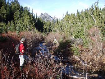
Eagle Creek with Merchant in the background
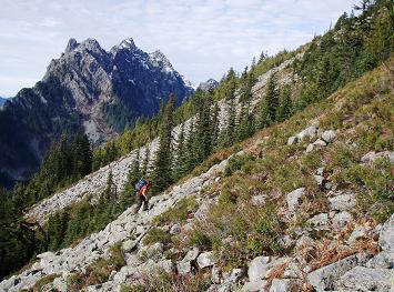
Merchant Peak from slopes of Townsend Mountain
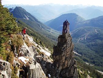
One of the towers south of Townsend Mountain's summit block
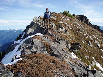
Lindsay on the west ridge of Townsend Mountain
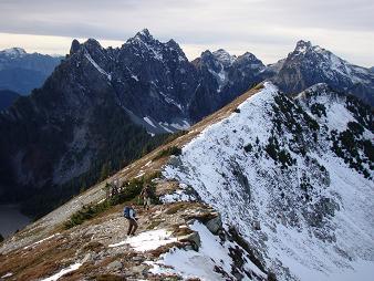
Merchant Peak and Gunn Peak behind the west ridge of Townsend Mountain from i
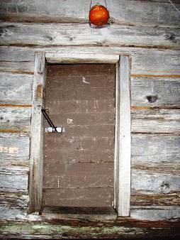
Cabin on Eagle Lake
Copyright © 2024 Gabriel Deal.