Duke of Kent
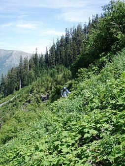
Andrea and I parked on Road 9020 at the Alice Creek washout. It is a
trashy dump here. We crossed Alice Creek then took the spur road that
goes up the Alice Creek basin and eventually ends below the Earls.
The road is much more brushy than it was a couple years ago.
At the end of the road we headed south up a loose talus field, making
a long, tedious traverse to the 4,520' pass on the south side of the
Duke. The final push to the pass involved steep duff scrambling where
we used our ice axes and brush belays.
The Rock Creek side of the pass felt completely different than the
Alice Creek side. The Alice Creek basin is logged out and not so
pleasant. The Rock Creek basin felt remote and rugged and we had a
nice view of a surprisingly scenic and gnarly ridge to the east. Even
the talus on the Rock Creek side was more stable. There were pretty
meadows. And we saw a marmot.
From the pass we dropped down 250', then traversed below rock
buttresses to a steep meadow/gully that led to the summit of the Duke.
The summit was a good place to lounge while enjoying 360 degree views.
Elevation gain:
3,125 feet
In:
South Fork Snoqualmie Drainage
Car-to-car:
9 hours 12 minutes
-
3 hours 31 minutes
ascending
from
Road 9020
to
pass south of the Duke
-
30 minutes
descending
from
pass south of the Duke
to
talus slope below cliffs
-
49 minutes
ascending
from
talus slope below cliffs
to
summit of the Duke of Kent
-
26 minutes
descending
from
summit of the Duke of Kent
to
talus below cliffs
-
3 hours 13 minutes
ascending
from
talus below cliffs
to
Road 9020