Avalanche Mountain via Snow Lake trail
Ian and I parked at the Snow Lake trailhead at Alpental and took the
trail to the east side of Snow Lake.
After crossing the big creek that runs into the east side of Snow
lake, we crossed a short boardwalk, then went right on a bootpath that
started a few feet down the trail on the right (two tall trees and an
interesting zig-zag tree are next to the bootpath). We followed
the bootpath up through beautiful meadowland with many more ponds than
the map shows. We ascended the side of ridge (the one that runs south
of Avalanche Mountain) to just below the rock bands and traversed
below the rock, finally ascending to a small notch (at about 5,000')
north of the gendarmes on the lower part of the ridge. The way we
descended would have been a better way to get here.
Once on the ridge we followed it up to the summit, sometimes dropping
down a bit on the west side of the ridge to avoid rock (if it had been
dry the rock may have been fun). The final 20 feet of ascent to the
summit was a pretty easy rock scramble.
The summit has a register, only 3 parties have signed it since its
first entry in June of 2003, maybe because it is so difficult to open.
It was a nice rocky summit with nothing to obstruct the views, but we
were pretty socked in by the clouds, so I can only imagine what the views
were of.
On the descent we followed the ridge south to the little notch around
5,000' and then descended from there. Once in the basin we made for
the highest lake and then followed the creek to the bootpath and back
to Snow Lake. This was a much better route.
Round-trip distance:
8 miles
Elevation gain:
3,030 feet
USGS quad:
Snoqualmie Pass
In:
Middle Fork Snoqualmie Drainage, Alpine Lakes Wilderness
Car-to-car:
7 hours 2 minutes
-
20 minutes
driving there
from
Lower Queen Anne
to
Mercer Island Park and Ride
-
4 minutes
driving there
from
Mercer Island Park and Ride
to
intersection of I-90 and I-405
-
21 minutes
driving there
from
intersection of I-90 and I-405
to
North Bend
-
7 minutes
driving there
from
North Bend
to
Snow Lake trailhead (Alpental)
-
59 minutes
ascending
from
Snow Lake trailhead (Alpental)
to
the pass on trail south of Snow Lake
-
25 minutes
ascending
from
the pass on trail south of Snow Lake
to
the intersection of the Snow Lake trail and the boot path
-
2 hours 6 minutes
ascending
from
the intersection of the Snow Lake trail and the boot path
to
Avalanche Mountain
-
1 hour 36 minutes
descending
from
Avalanche Mountain
to
the intersection of the Snow Lake trail and the boot path
-
31 minutes
descending
from
the intersection of the Snow Lake trail and the boot path
to
the pass on trail south of Snow Lake
-
59 minutes
descending
from
the pass on trail south of Snow Lake
to
Snow Lake trailhead (Alpental)
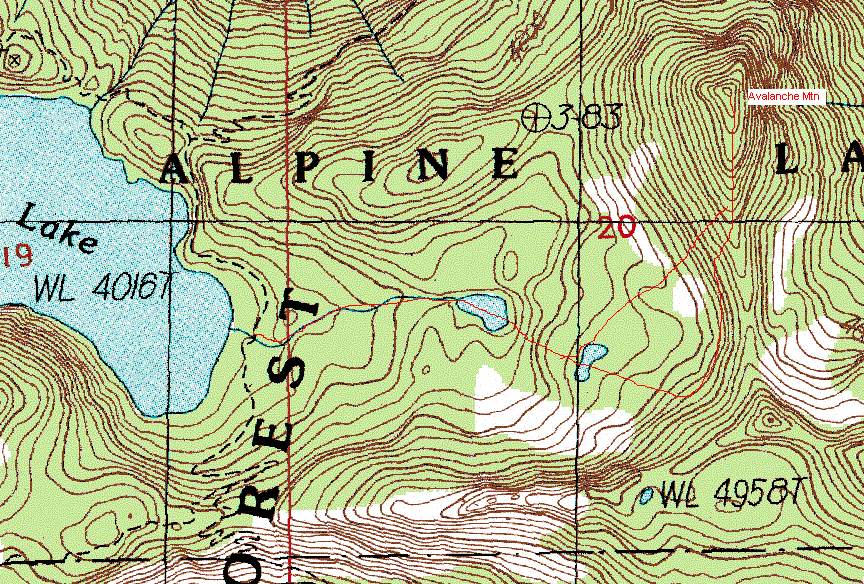
Avalanche Mountain map
Copyright © 2026 Gabriel Deal.