Cannon, Enchantment, Dragontail, and Witches Tower
Cannon Mountain. We approached via Prusik Pass. We found a cairned
bootpath that starts slightly to the west of the pass and heads NW,
contouring the slopes on the north side of the ridge. We completely
overshot and accidently summited Elf Ridge first. Oops. Once we
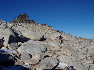
oriented ourselves, it was a straight-forward scramble to Druid
Plateau (the 8,320'+ plateau just below the summit) via the east
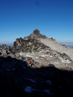
slopes. The summit of Cannon was a rock scramble, and the last 15-20
feet was steep and slabby. It was a little intimidating downclimbing
the short section of slabby rock at the top, a slip could have
deposited us 30 feet down the slope.
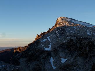
Enchantment Peak, NE summit. The NE summit was a straight-forward
walk-up from Prusik Pass, with 15 feet of 3rd class scrambling to the
top. We checked out the SW summit and decided it was far past what
we'd be willing to do with only a 30 meter rope and a few biners and
slings. Too bad since I'm not clear which summit is the true summit.
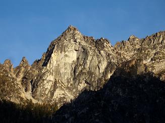
Dragontail Peak. The standard Valhalla Cirque route was out because
the glacier was mostly ice. So we skirted the SE side of Isolation
Lake, then ascended granite slopes to the 8,120'+ pass between Little
Annapurna and Dragontail Peak. At the pass we walked across the
snowfield at the top of the Snow Creek Glacier, then ascended SW to
the Dragontail Plateau. From the plateau, we hiked the west side of the ridge
to the top of Dragontail.
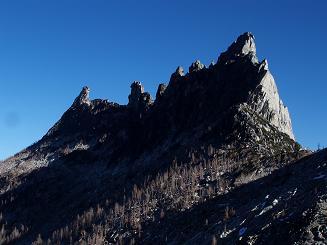
Witches Tower. This was my favorite. It started with a short,
exposed, slabby ledge on the SSE side. The ledge was very easy, but a
bit intimidating with all the exposure. After this short section, it
was a fun, unexposed rock scramble to the summit, with a bit of 3rd
class. The top was solid granite and very roomy with loads of
exposure on all sides.
On the hike down my headlamp batteries gave out just as we reached the
car. How convenient.
Date:
2006/10/20
to 2006/10/22
Elevation gain:
8,300 feet
USGS quads:
Enchantment Lakes, Cashmere Mountain
In:
Alpine Lakes Wilderness
Car-to-car:
3 days
-
2 hours 52 minutes
driving there (via Blewett Pass)
from
Capitol Hill
to
Colchuck Lake trailhead
-
4 hours 51 minutes
ascending
from
Colchuck Lake trailhead
to
Aasgard Pass
-
1 hour 26 minutes
ascending
from
Aasgard Pass
to
camp above Crystal Lake
-
5 hours 3 minutes
ascending
from
camp above Crystal Lake
to
Cannon Mountain summit
-
2 hours 18 minutes
ascending
from
Cannon Mountain summit
to
Enchantment Peak, NE summit
-
39 minutes
descending
from
Enchantment Peak, NE summit
to
near Enchantment Peak, SW summit
-
1 hour 13 minutes
descending
from
near Enchantment Peak, SW summit
to
camp above Crystal Lake
-
3 hours 35 minutes
ascending
from
camp above Crystal Lake
to
Dragontail Peak summit
-
1 hour 48 minutes
descending
from
Dragontail Peak summit
to
Witches Tower summit
-
5 hours 2 minutes
descending
from
Witches Tower summit
to
Colchuck Lake trailhead
-
2 hours 47 minutes
driving back (via Blewett Pass)
from
Colchuck Lake trailhead
to
Capitol Hill
East side of Dragontail Peak
NE side of Little Annapurna
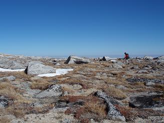
Druid Plateau
Prusik Peak and The Temple from N of Prusik Pass
Enchantment Peak, NE summit
Enchantment Peak, NE summit
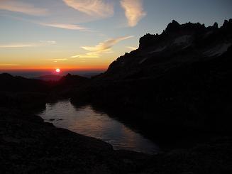
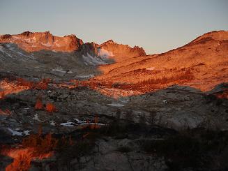
McClellan Peak at sunrise
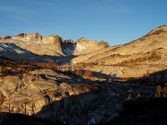
East side of Dragontail Peak
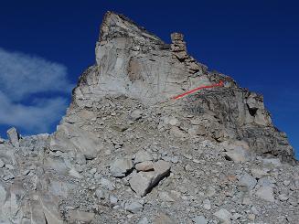
Slab route up east side of Witches Tower
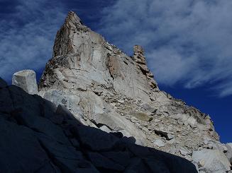
East side of Witches Tower
Jabberwocky Tower from Aasgard Pass
Colchuck Balanced Rock from Colchuck Lake
Copyright © 2026 Gabriel Deal.