Middle Fork Snoqualmie climb approaches
*** Garfield Mountain alpine route, south approach
I parked on the Middle Fork Road 2.6 miles from the Taylor River
Bridge. This is the site of a wash that looks like it is used as a
gravel pit.
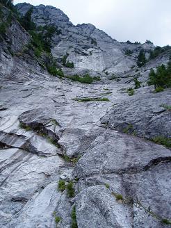
I hiked up the wash to the falls. The falls ran down a series of
water-sculpted, granite slabs. This is a great destination in itself.
There was a boot path that started to the right (east) of the base of
the falls. It ran along the east side of the creek until it faded out
at a spot with a good view of Garfield's impressive rock faces.
*** Infinite Bliss approach
I parked on the Middle Fork Road 1.1 miles from the Taylor River
Bridge on a parking spot on the right (south) side of the road. 50
feet up the road (east) a trail headed north toward Garfield.
When the trail crossed a slabby creek bed, I decided to follow the
slabs up. The slabs went on for a few hundred feet, they were fun.
At the end of the slabs I cut right (east) back to the trail. The
trail is decent and well-traveled, toward the end it becomes very
steep and has one scrambly spot.
The base of the climb was an excellent viewpoint. The views of the
rock walls above were excellent, and the views of the Middle Fork
Valley were nice but far from sweeping. Choirboy, the Fee Demo Wall,
and The Seven Beauties were in sight.
I tried to spot the bolts, but only caught a glimpse of one. When I
got home I found a report that said the bolts had been chopped.
Despite this, there were two climbers a few pitches up the climb when
I was there.
*** Fee Demo Wall
I parked at the Middle Fork Trailhead and hiked up the Middle Fork
Trail. There are fantastic views of Garfield Mountain just a few
minutes down this trail. The turn-off for the Fee Demo Wall was
pretty obvious, I could see the wall through the trees and the trail
seemed reasonably well traveled.
The path to the wall forked left and right, the left fork didn't seem
to go to any climb but according to the topo there are climbs there.
On the right fork I found half a dozen bolted, slabby, fun-looking
climbs.
Elevation gain:
2,540 feet
In:
Middle Fork Snoqualmie Drainage
Car-to-car:
5 hours 27 minutes
-
1 hour 20 minutes
driving there
from
Lower Queen Anne
to
Garfield Creek falls trailhead
-
1 hour 49 minutes
ascending
from
Garfield Creek falls trailhead
to
past top of the trail above the falls
-
1 hour 47 minutes
descending
from
past top of the trail above the falls
to
Garfield Creek falls trailhead
-
36 minutes
ascending
from
Infinite Bliss trailhead
to
base of Infinite Bliss climb
-
24 minutes
descending
from
base of Infinite Bliss climb
to
Infinite Bliss trailhead
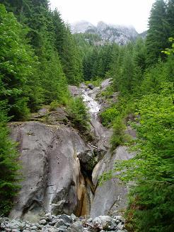
Garfield Mountain falls
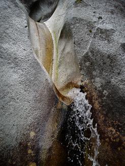
Garfield Mountain falls
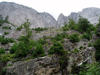
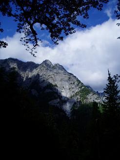
Garfield Mountain from the top of the Garfield Mountain falls boot path
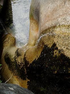
Looking down on Garfield Mountain falls
Infinite Bliss from the base of the climb
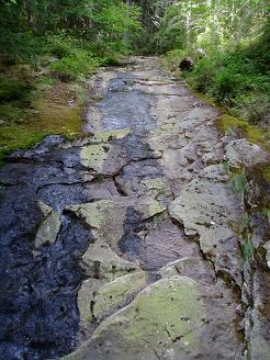
Slabby creek bed on the Infinite Bliss approach trail
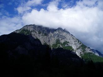
Garfield Mountain from the Middle Fork Trail
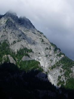
Infinite Bliss on Garfield Mountain from the Middle Fork Trail
Garfield Mountain from the Middle Fork Trail
Copyright © 2026 Gabriel Deal.