Trips
Favorite photos
Peak lists
References
Search
Avalanche Mountain summit bivy
Date:
2017/09/10 to 2017/09/11
Car-to-car:
16 hours 53 minutes
Round-trip distance:
8 miles
Elevation gain:
3,000 feet
Trip type:
scramble
USGS quad:
Snoqualmie Pass
In:
Middle Fork Snoqualmie Drainage, Alpine Lakes Wilderness
Loading map...
Day 1
Snow Lake Trail one hour before sunset.
Photo shoot of Mukmuk at the Alpine Lakes Wilderness boundary
Tarn at sunset
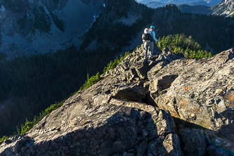
On the ridge between Snoqualmie Mtn and Avalanche Mtn
The Snoqualmie Range
Snoqualmie Mountain
25 minutes after sunset we are nearly at the summit of Avalanche Mtn
Dinner on the summit under the stars
Our bivy spot on top of Avalanche Mtn and under the Milky Way
Day 2
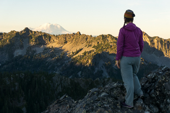
Pre-sunrise with Snoqualmie Mountain
The Tooth, Hemlock Peak, and Bryant Peak
Bryant Peak
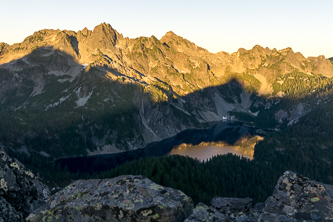
Chair Peak and Snow Lake
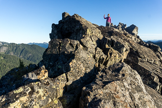
The summit of Avalanche Mountain
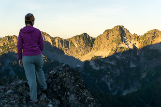
Snoqualmie Mountain
Chair Peak over 4,480' tarn
Chair Peak over 4,240' tarn
Bryant Peak over the Snow Lake Trail
Fireweed blizzard
Copyright © 2026 Gabriel Deal.
‹
›
×